
 Ελληνικά
Flood management measures
Adjustment of waterway
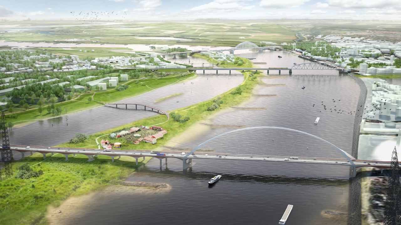
Adjustment of the waterway contains every constructional measure to a navigable channel, e.g. Broadening of curved waterways, deepening of the wat...
Afforestation
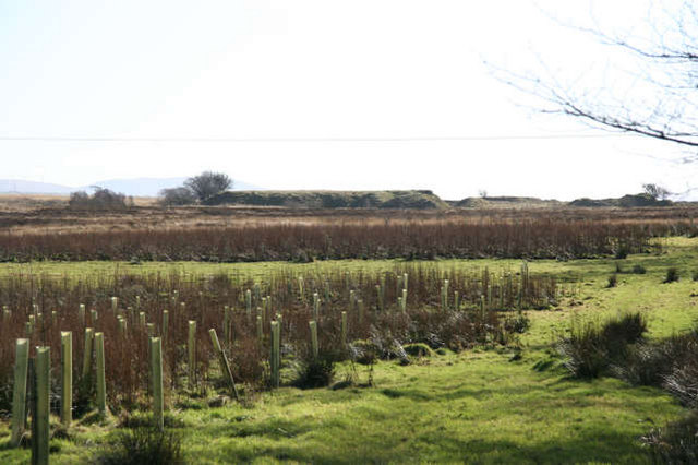
Land use conversion is a general term for large scale geographic change. Afforestation is one such land conversion in which trees are planted on pr...
Aquifer recharge
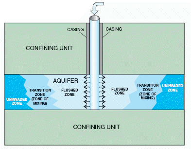
Aquifer recharge is achieved by adding surface water in basins, furrows, ditches, wells or other facilities where it infiltrates into the soil and ...
Breakwater
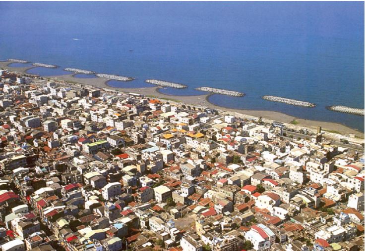
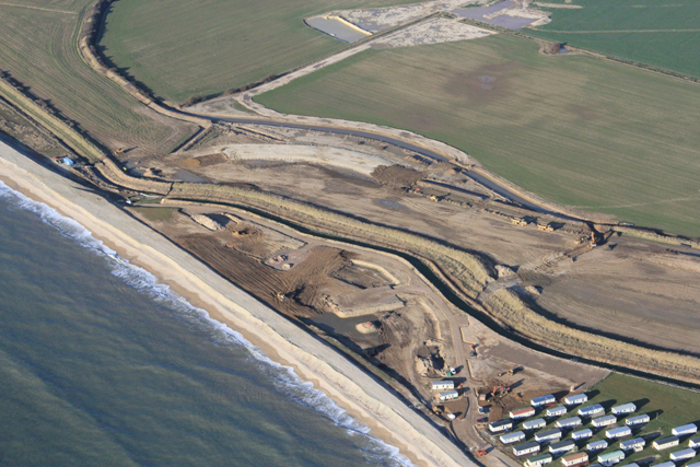
Breakwaters are structures constructed on coasts as part of coastal defense or to protect a port and port entrance from the effects of both heavy s...
Bypass channel
Bypass channel, also known as a flood-relief channel, is an artificially made waterway constructed in order to protect urban and rural agricultural...
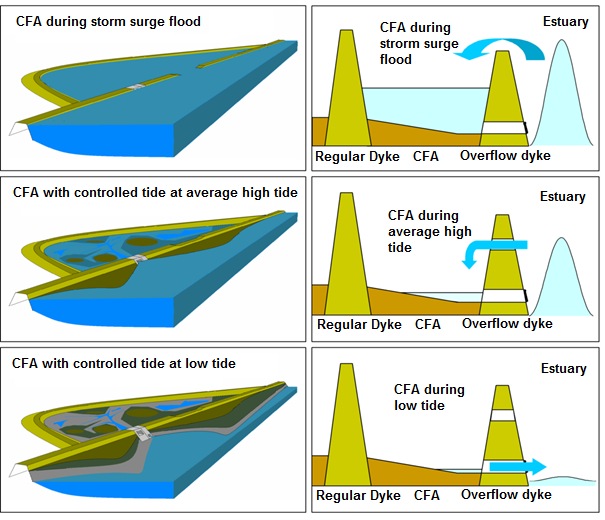
Cascading flood compartment system
The “system of cascading flood compartments” combines area prevention with constructional solutions. The idea is to (re)build a second dikeline of ...
Creation of a second dike line
A second dike line is created by building other dikes, mostly bigger dikes, on the water side of existing dikes, which will not be removed. Buildin...
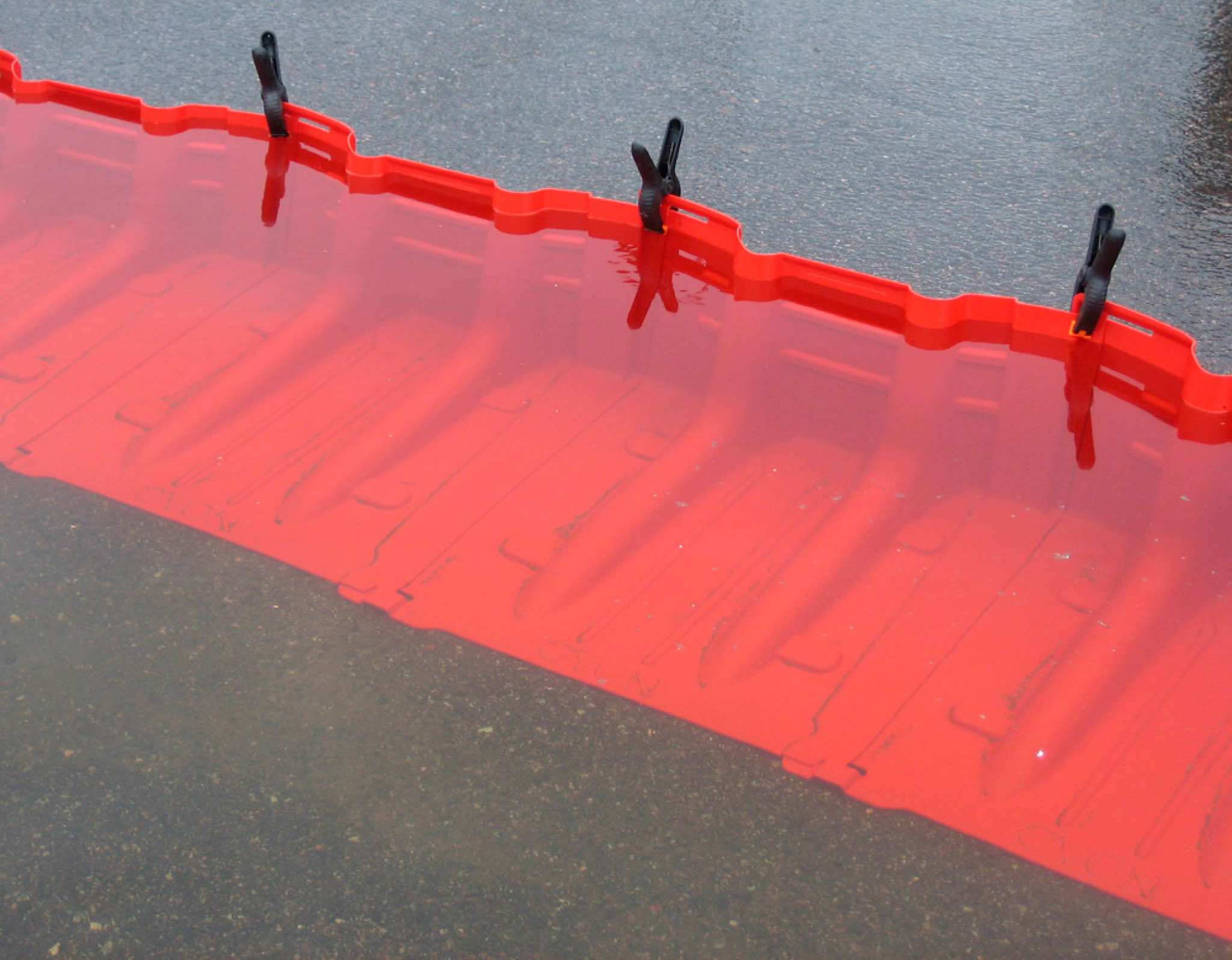
Demountable flood protection barrier
Demountable flood protection barriers consist of a combination of removable and pre-installed permanent components. The system is planned to be ere...
Dike
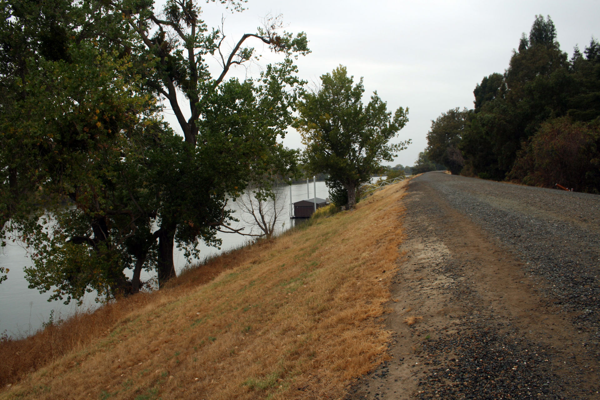
A dike or levee is an elongated artificially constructed embankment, which protects low-lying areas against higher water levels. It is usually made...
Dike inspection and/or recovery
Inspection of the flood protection dikes takes place in order to observe and assess the state of the dike and especially after a storm surge events...
Dike reinforcement
Dike reinforcement describes the process of strengthening the dike by e.g. raising the dike height, widening of the dike crest, broadening the who...
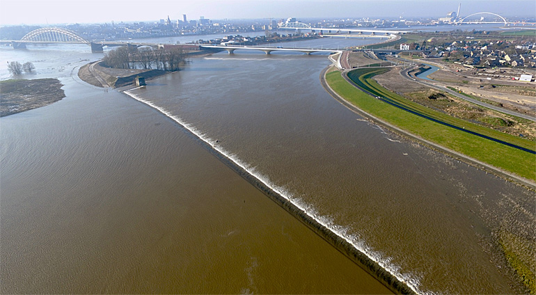
Dike relocation
A new dike is built further away from the river or the coast after which the existing dike is removed. This leads to an increase of the flood plain...
Dredging of watercourse
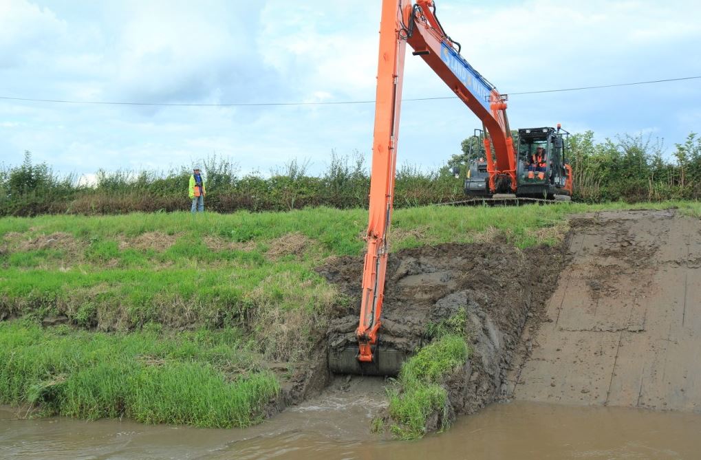
The term dredging is used to refer to the systematic removal of accumulated material from river or other watercourse channels. In its most extreme...
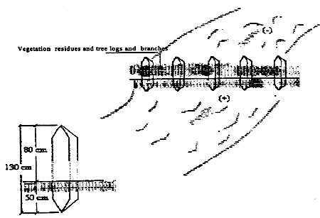
Fascine
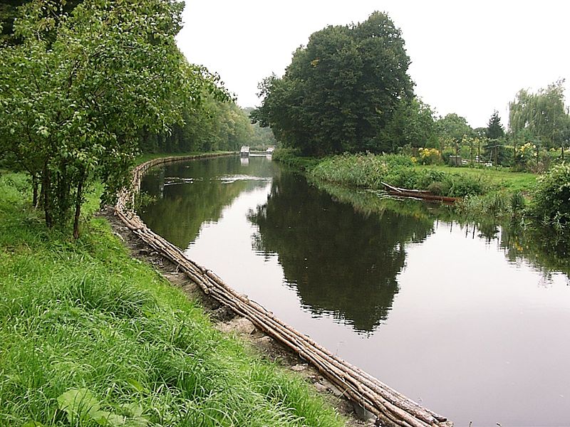
A fascine is a bundle of sticks or brushwood used in construction, generally to strengthen an earthen structure, fill ditches, or make a path acros...
Flexible water level management
Flexible water level management involves anticipating precipitation that has been forecast. The water level is lowered before a shower is expected,...
Flood control dam
A flood control dam is a dam built to catch surface runoff and stream water flow in order to regulate the water flow in areas below the dam. Flood ...
Flood forecasting and early warning
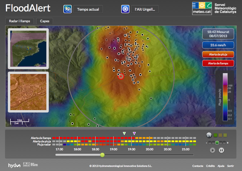
Flood forecasting is an important component of flood warning. Flood forecasting involves prediction of water levels and flows at particular locatio...
Flood gate
These barriers are made of a single or pair of rigid sections (usually steel or fibreglass), designed to close a gap within a flood defence. They a...
Flood hazard mapping
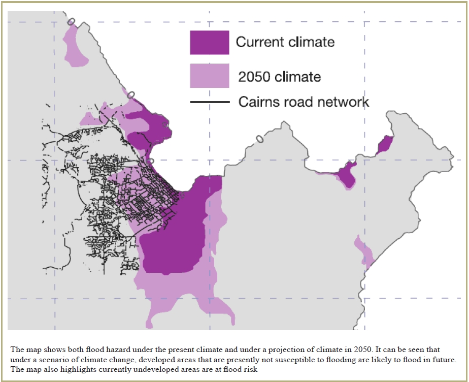
Flood hazard mapping is an exercise to define those areas which are at risk of flooding under extreme conditions. As such, its primary objective is...
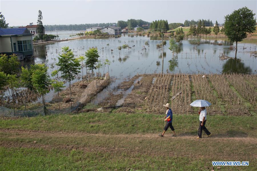
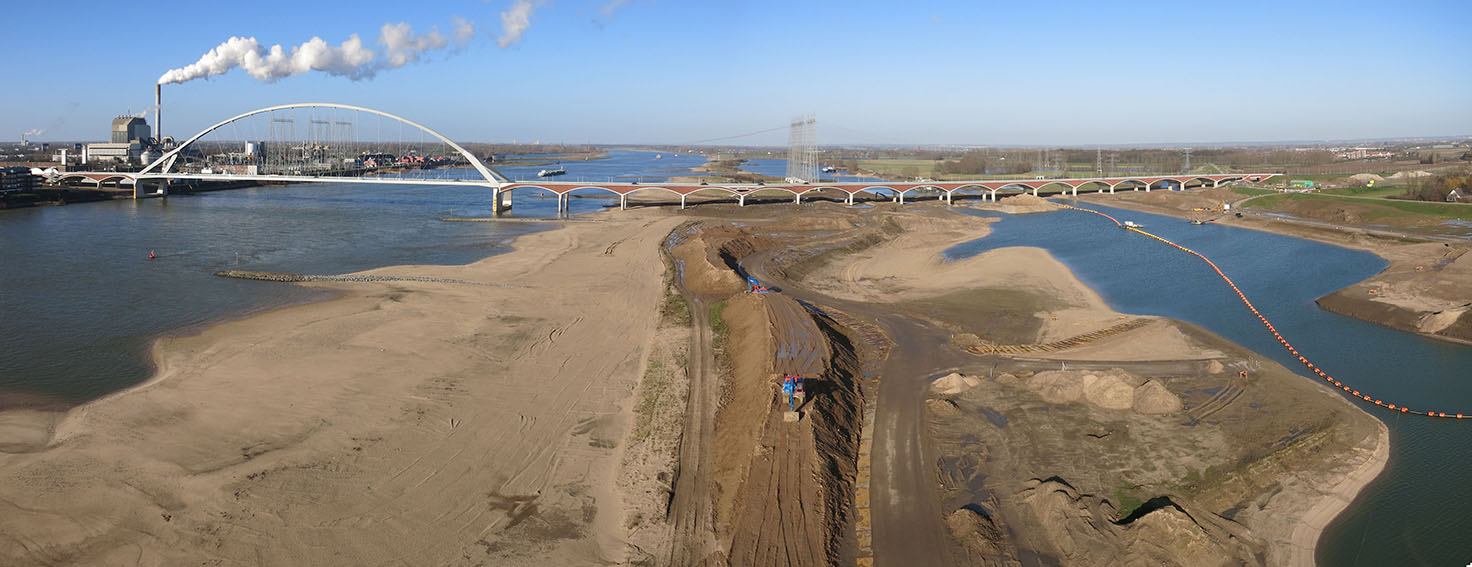
Floodplain excavation
Floodplain excavation is a measure by which gradual height increase caused by sedimentation on flood plains may be counteracted. The floodplain can...
Flood proof infrastructure
Evacuation routes and infrastructure in cities that are prone to flooding need to be flood proofed. Available options to reduce the negative impact...
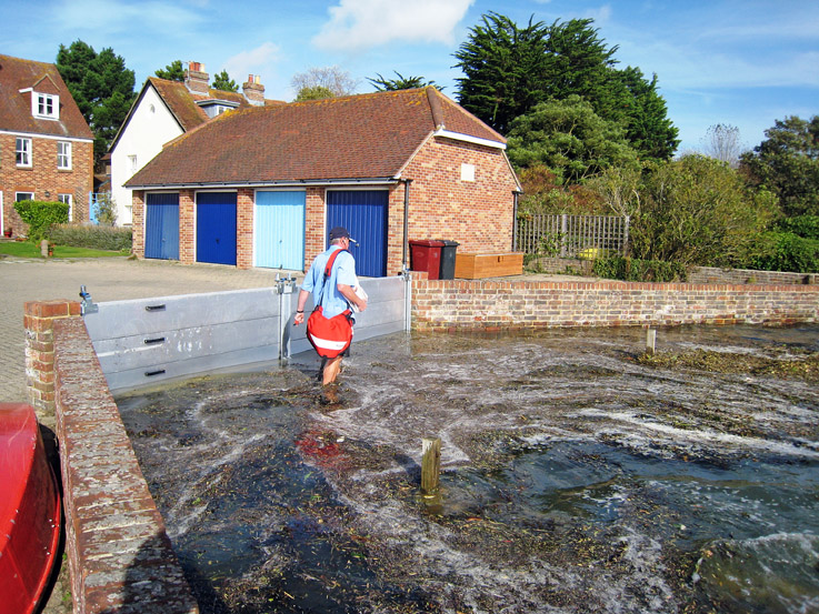
Freestanding barrier
These modular systems are made of impermeable materials and are joined together to form a continuous barrier or wall. These products are self suppo...
Groyne
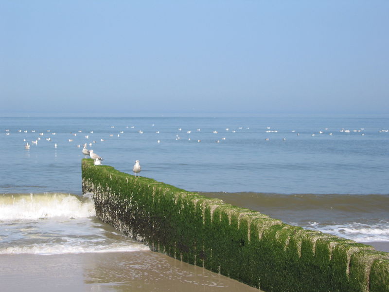
A groyne is normally a straight structure perpendicular to the shoreline. Groynes work by blocking (part of) the littoral drift, whereby they trap/...
Hydraulic filling
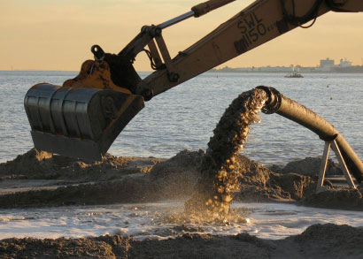
Hydraulic Fill is fill in which the materials are deposited by a flowing stream of water. This fill material will originate from a borrow area or d...
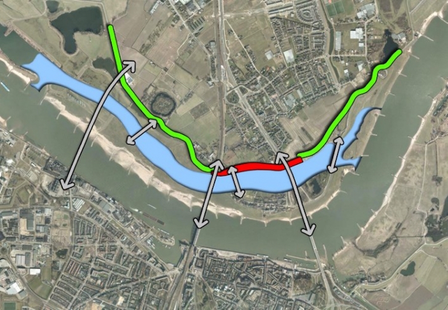
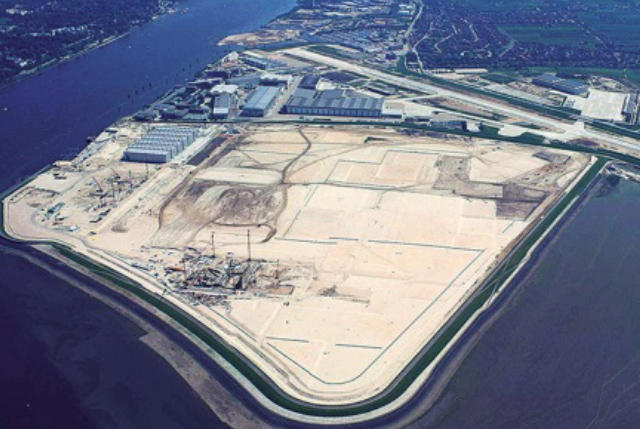
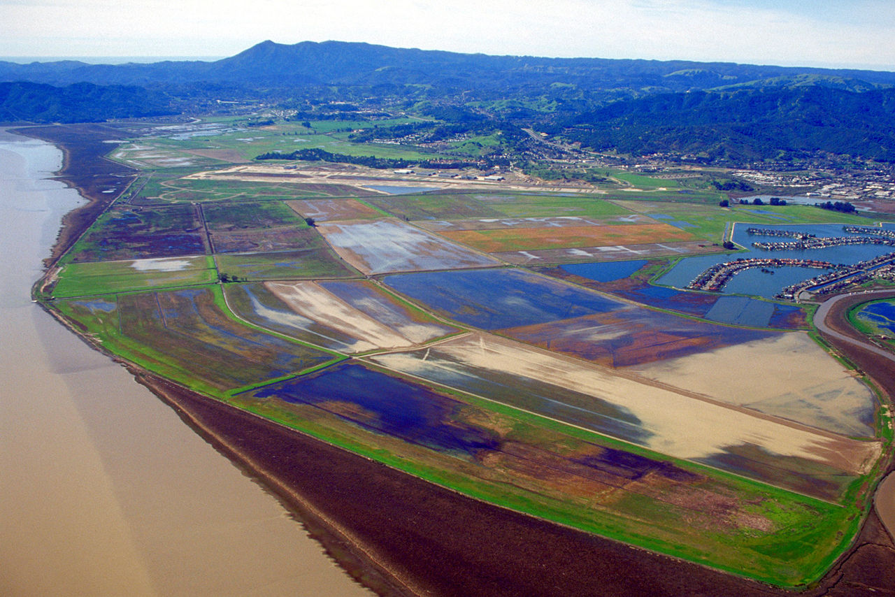
Managed realignment
Managed realignment or managed retreat allows an area that was not previously exposed to flooding by the sea to become flooded by removing coastal ...
Multi-functional flood defences

Multifunctional Flood Defences (MFD) is a newly developed concept to optimize allocation of urban space rather than constructing stand-alone struct...
Multi-layer safety as a central concept for flood protection
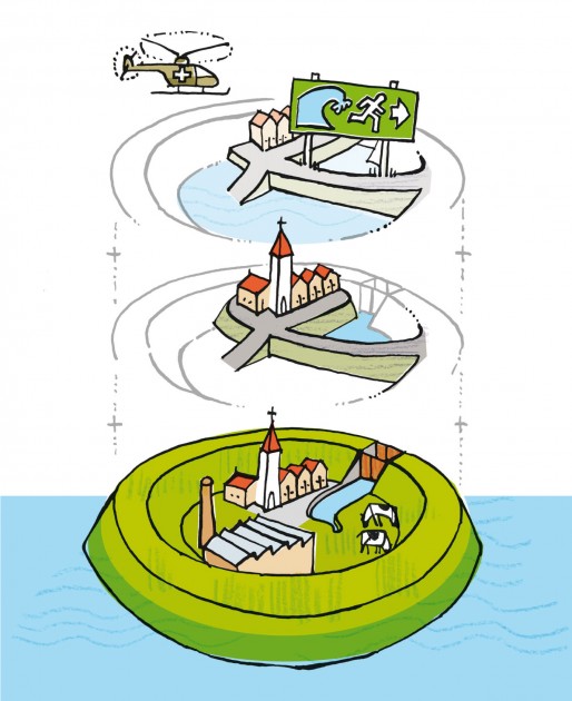
The central concept for the revised water safety policy is formed by 'multi-layer safety'. In this concept safety is assured through multiple layer...
Network of waterways
Ένα δίκτυο εσωτερικής ναυσιπλοΐας εστιάζει κυρίως στη διασύνδεση των υδάτινων σωμάτων που βρίσκονται σε κοντινές αποστάσεις. Συνδέοντάς τα, με υπόγ...
Polder
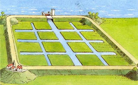
A polder is a low-lying tract of land enclosed by embankments (barriers) known as dikes that forms an artificial hydrological entity, meaning it ha...
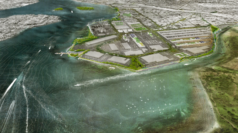
Port restructuring
Restructuring of the layout of the port, its equipment and flood protection system.
Revetment
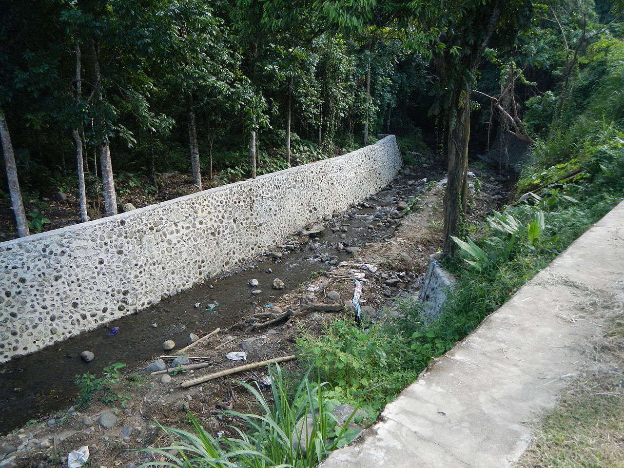
Revetments are sloping structures placed on banks or cliffs in such a way as to absorb the energy of incoming water. River or coastal revetments ar...
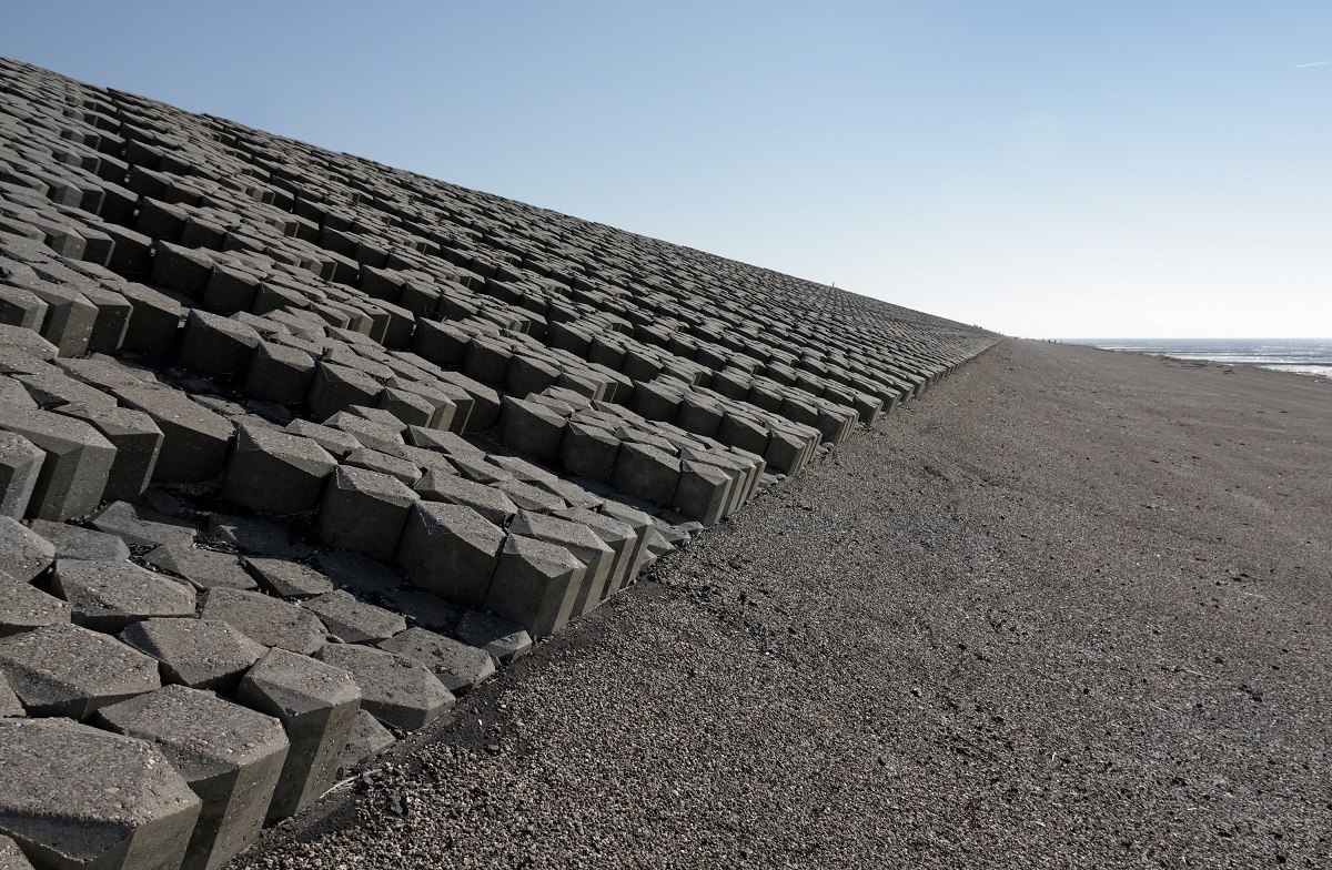
Rip rap
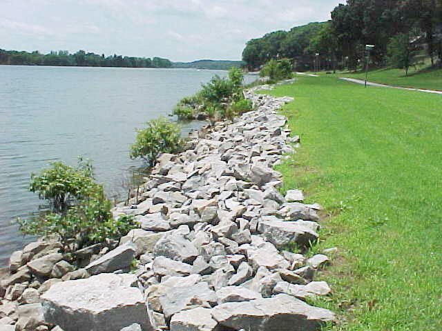
Rip rap is large boulders of rock that are placed along the edge of the coastline and is sometimes referred to as rock armouring. They work by diss...
River Training
River training refers to the structural measures which are taken to improve a river and its banks. River training is an important component in the ...
Sandbag wall
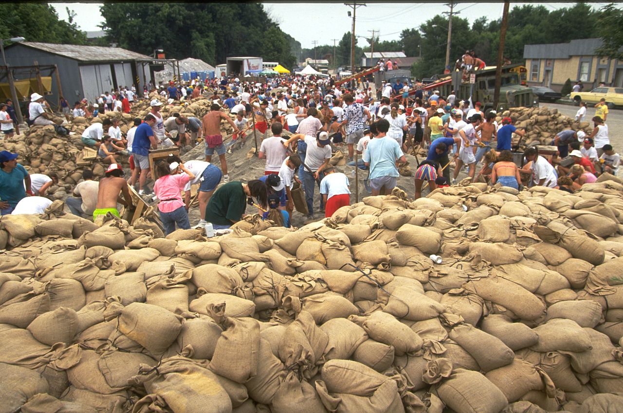
A sandbag is a bag or sack made of hessian / burlap, polypropylene or other materials, that is filled with sand or soil and it is used for flood de...
Sectional barrier
These systems consist of multiple sections made of rigid materials such as steel or fibreglass which are joined or interlocked to form a continuous...
Sediment replenishment
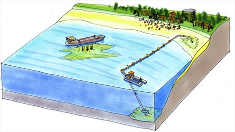
Sediment replenishment method is one of new measures of sediment management mostly used in river systems where dams/reservoirs have been created. I...
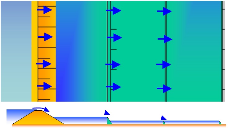
Seepage barrier
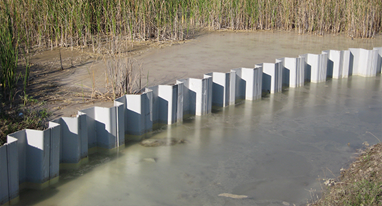
Seepage barriers are constructed in order to control and mitigate the subsurface flow, or seepage of water. Depending on the method employed, they...
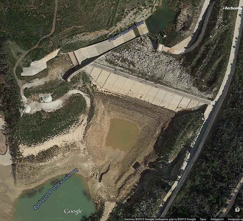
Sludge retention tank in Lake Makria

It is located west of the New Port of Limassol. The existing natural lake was formed and a basin was built at the entrance to hold the mud so it w...
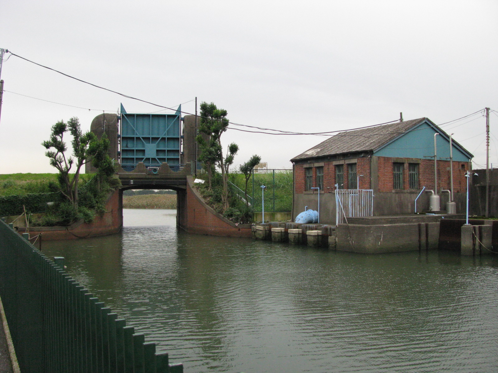
Sluice
A sluice is a gate used to control the rate of flow of water. It fulfills the function of a flood protection and hinterland drainage. In normal ope...
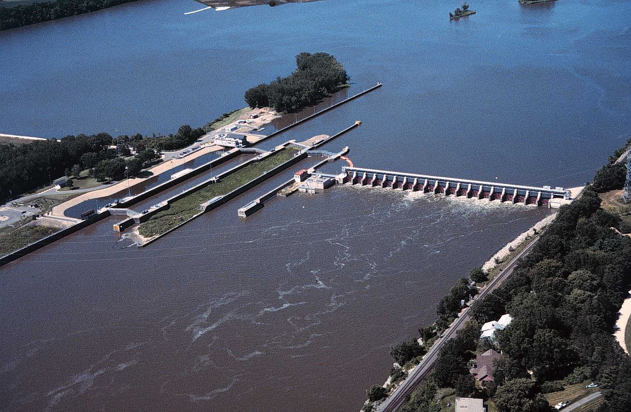
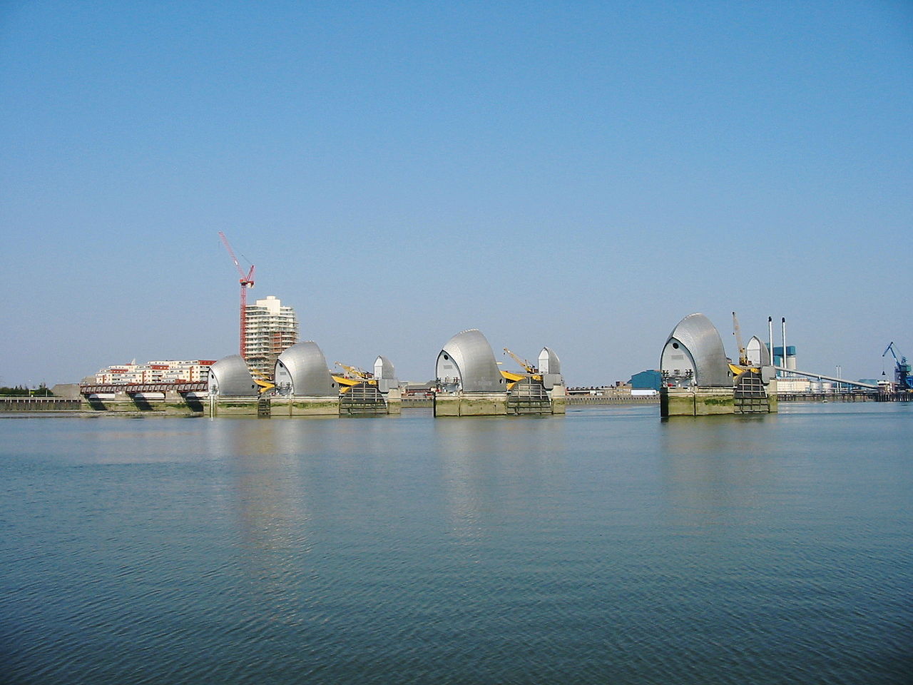
Storm surge barrier
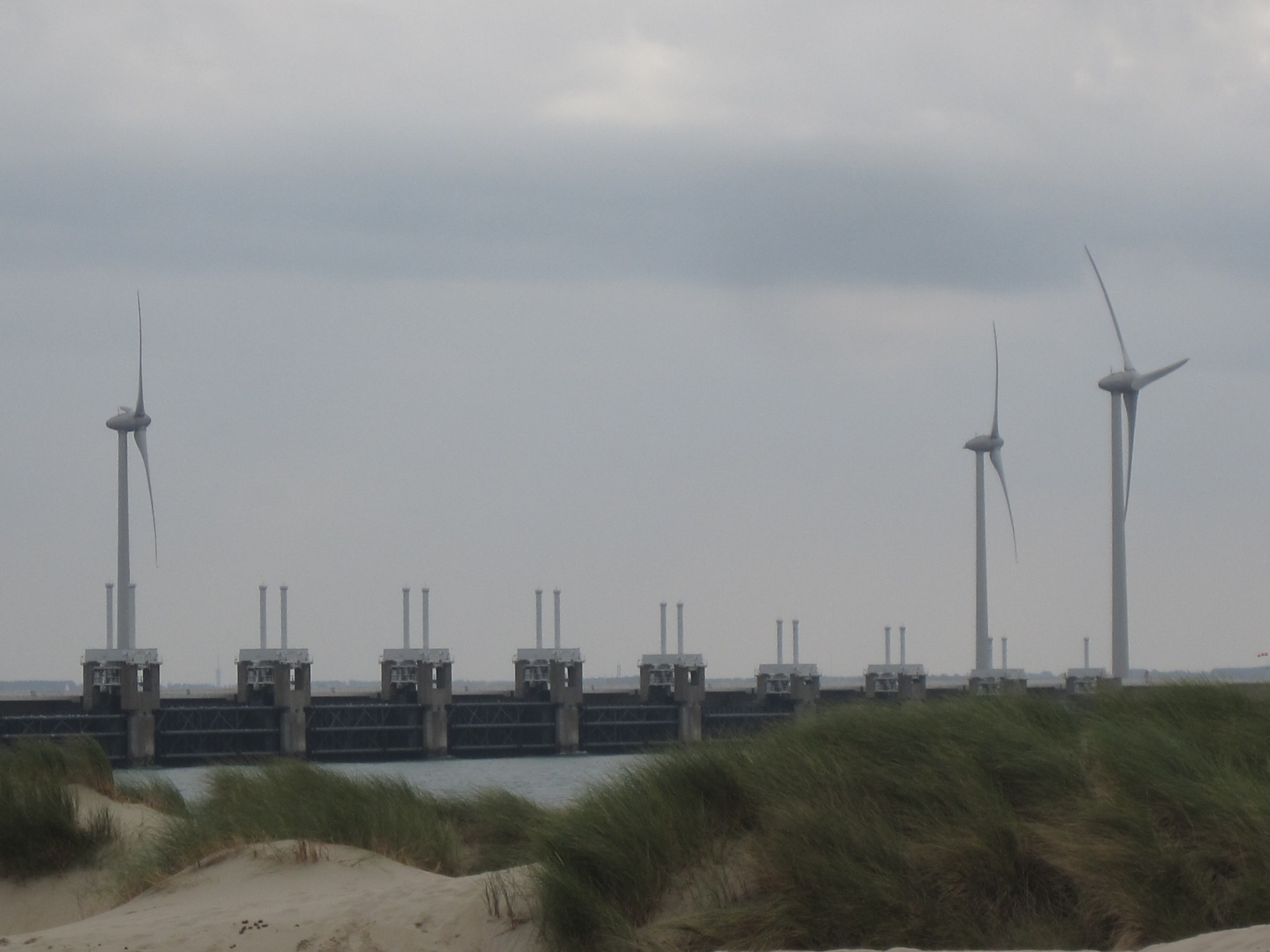
Storm surge barriers are hard engineered structures with a primary function of preventing coastal flooding. Their secondary role is to shorten the ...
Stormwater harvesting system
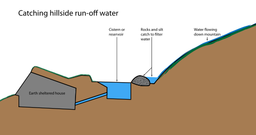
Stormwater harvesting (SWH) consists in collecting, storing and reusing stormwater collected from drains or creeks, on the contrary to rainwater ha...
Toroba
Toroba is a homemade diversion structure that is used to divert flood water for water supply augmentation. It is built of wooden poles, taken from ...
Tubes
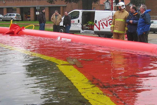
Tubes (air filled or water filled) flood protection products are typically pre-fabricated geo-membrane or reinforced PVC tubes filled with air or w...
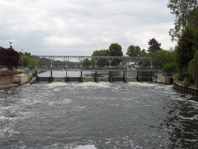
Weir
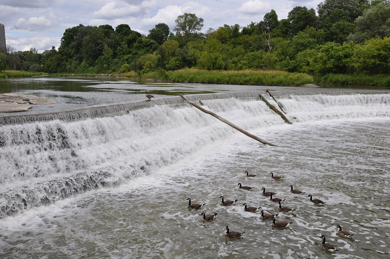
A weir is a barrier across a river designed to alter the flow characteristics. In most cases weirs take the form of obstructions smaller than most ...
Wetland and wetland restoration
A wetland (Natural or Constructed/Artificial) is a land area that is saturated with water, either permanently or seasonally, such that it takes on ...

Flood management measures
| Name | Definition |
|---|---|
| Adjustment of waterway | Adjustment of the waterway contains every constructional measure to a navigable channel, e.g. Broadening of curved waterways, deepening of the ... |
| Afforestation | Land use conversion is a general term for large scale geographic change. Afforestation is one such land conversion in which ... |
| Aquifer recharge | Aquifer recharge is achieved by adding surface water in basins, furrows, ditches, wells or other facilities where it infiltrates into ... |
| Breakwater | Breakwaters are structures constructed on coasts as part of coastal defense or to protect a port and port entrance from ... |
| Bypass channel | Bypass channel, also known as a flood-relief channel, is an artificially made waterway constructed in order to protect urban and ... |
| Cascading flood compartment system | The “system of cascading flood compartments” combines area prevention with constructional solutions. The idea is to (re)build a second dikeline ... |
| Creation of a second dike line | A second dike line is created by building other dikes, mostly bigger dikes, on the water side of existing dikes, ... |
| Demountable flood protection barrier | Demountable flood protection barriers consist of a combination of removable and pre-installed permanent components. The system is planned to be ... |
| Dike | A dike or levee is an elongated artificially constructed embankment, which protects low-lying areas against higher water levels. It is ... |
| Dike inspection and/or recovery | Inspection of the flood protection dikes takes place in order to observe and assess the state of the dike and ... |
| Dike reinforcement | Dike reinforcement describes the process of strengthening the dike by e.g. raising the dike height, widening of the dike crest, ... |
| Dike relocation | A new dike is built further away from the river or the coast after which the existing dike is removed. ... |
| Dredging of watercourse | The term dredging is used to refer to the systematic removal of accumulated material from river or other watercourse channels. ... |
| Fascine | A fascine is a bundle of sticks or brushwood used in construction, generally to strengthen an earthen structure, fill ditches, ... |
| Flexible water level management | Flexible water level management involves anticipating precipitation that has been forecast. The water level is lowered before a shower is ... |
| Flood control dam | A flood control dam is a dam built to catch surface runoff and stream water flow in order to regulate ... |
| Flood forecasting and early warning | Flood forecasting is an important component of flood warning. Flood forecasting involves prediction of water levels and flows at particular ... |
| Flood gate | These barriers are made of a single or pair of rigid sections (usually steel or fibreglass), designed to close a ... |
| Flood hazard mapping | Flood hazard mapping is an exercise to define those areas which are at risk of flooding under extreme conditions. As ... |
| Floodplain excavation | Floodplain excavation is a measure by which gradual height increase caused by sedimentation on flood plains may be counteracted. The ... |
| Flood proof infrastructure | Evacuation routes and infrastructure in cities that are prone to flooding need to be flood proofed. Available options to reduce ... |
| Freestanding barrier | These modular systems are made of impermeable materials and are joined together to form a continuous barrier or wall. These ... |
| Groyne | A groyne is normally a straight structure perpendicular to the shoreline. Groynes work by blocking (part of) the littoral drift, ... |
| Hydraulic filling | Hydraulic Fill is fill in which the materials are deposited by a flowing stream of water. This fill material will ... |
| Managed realignment | Managed realignment or managed retreat allows an area that was not previously exposed to flooding by the sea to become ... |
| Multi-functional flood defences | Multifunctional Flood Defences (MFD) is a newly developed concept to optimize allocation of urban space rather than constructing stand-alone structures. ... |
| Multi-layer safety as a central concept for flood protection | The central concept for the revised water safety policy is formed by 'multi-layer safety'. In this concept safety is assured ... |
| Network of waterways | Ένα δίκτυο εσωτερικής ναυσιπλοΐας εστιάζει κυρίως στη διασύνδεση των υδάτινων σωμάτων που βρίσκονται σε κοντινές αποστάσεις. Συνδέοντάς τα, με υπόγεια ... |
| Polder | A polder is a low-lying tract of land enclosed by embankments (barriers) known as dikes that forms an artificial hydrological ... |
| Port restructuring | Restructuring of the layout of the port, its equipment and flood protection system. |
| Revetment | Revetments are sloping structures placed on banks or cliffs in such a way as to absorb the energy of incoming ... |
| Rip rap | Rip rap is large boulders of rock that are placed along the edge of the coastline and is sometimes referred ... |
| River Training | River training refers to the structural measures which are taken to improve a river and its banks. River training is ... |
| Sandbag wall | A sandbag is a bag or sack made of hessian / burlap, polypropylene or other materials, that is filled with ... |
| Sectional barrier | These systems consist of multiple sections made of rigid materials such as steel or fibreglass which are joined or interlocked ... |
| Sediment replenishment | Sediment replenishment method is one of new measures of sediment management mostly used in river systems where dams/reservoirs have been ... |
| Seepage barrier | Seepage barriers are constructed in order to control and mitigate the subsurface flow, or seepage of water. Depending on the ... |
| Sludge retention tank in Lake Makria | It is located west of the New Port of Limassol. The existing natural lake was formed and a basin was ... |
| Sluice | A sluice is a gate used to control the rate of flow of water. It fulfills the function of a ... |
| Storm surge barrier | Storm surge barriers are hard engineered structures with a primary function of preventing coastal flooding. Their secondary role is to ... |
| Stormwater harvesting system | Stormwater harvesting (SWH) consists in collecting, storing and reusing stormwater collected from drains or creeks, on the contrary to rainwater ... |
| Toroba | Toroba is a homemade diversion structure that is used to divert flood water for water supply augmentation. It is built ... |
| Tubes | Tubes (air filled or water filled) flood protection products are typically pre-fabricated geo-membrane or reinforced PVC tubes filled with air ... |
| Weir | A weir is a barrier across a river designed to alter the flow characteristics. In most cases weirs take the ... |
| Wetland and wetland restoration | A wetland (Natural or Constructed/Artificial) is a land area that is saturated with water, either permanently or seasonally, such that ... |