
 Ελληνικά
Flood management measures
Afforestation
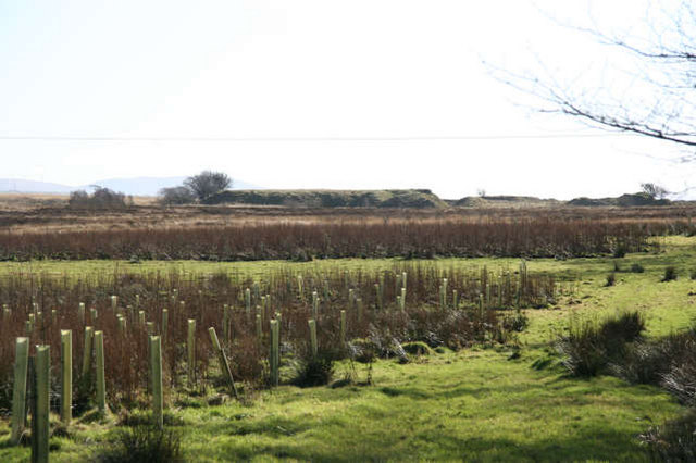
Land use conversion is a general term for large scale geographic change. Afforestation is one such land conversion in which trees are planted on pr...
Aquifer recharge
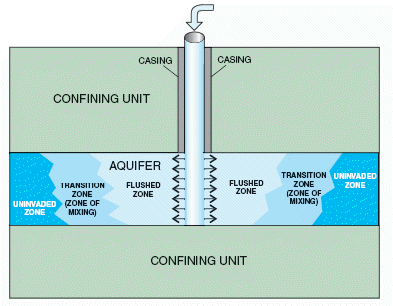
Aquifer recharge is achieved by adding surface water in basins, furrows, ditches, wells or other facilities where it infiltrates into the soil and ...
Bypass channel
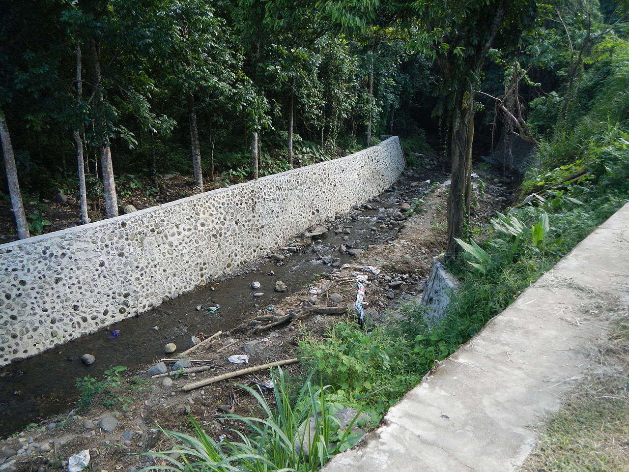
Bypass channel, also known as a flood-relief channel, is an artificially made waterway constructed in order to protect urban and rural agricultural...
Fascine
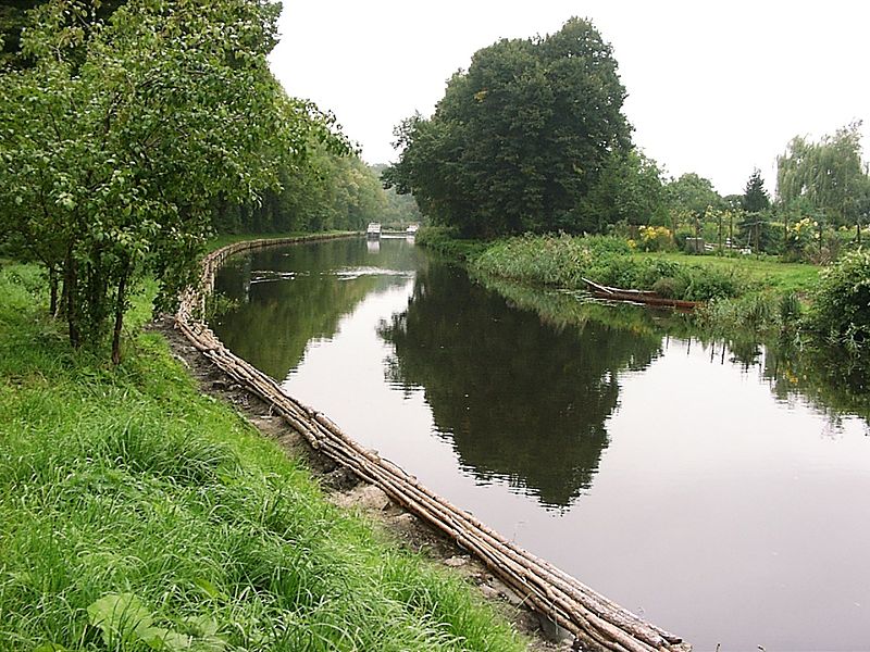
A fascine is a bundle of sticks or brushwood used in construction, generally to strengthen an earthen structure, fill ditches, or make a path acros...
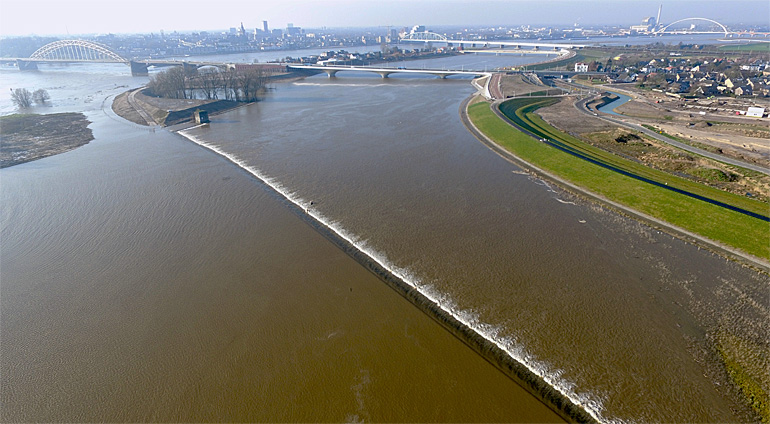
Floodplain excavation
Floodplain excavation is a measure by which gradual height increase caused by sedimentation on flood plains may be counteracted. The floodplain can...
Groyne
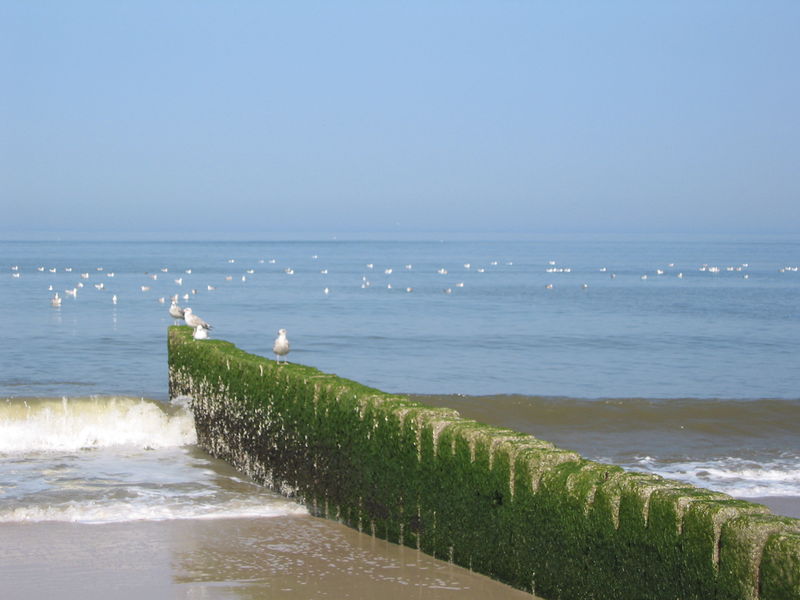
A groyne is normally a straight structure perpendicular to the shoreline. Groynes work by blocking (part of) the littoral drift, whereby they trap/...
Hydraulic filling
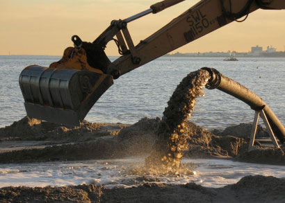
Hydraulic Fill is fill in which the materials are deposited by a flowing stream of water. This fill material will originate from a borrow area or d...
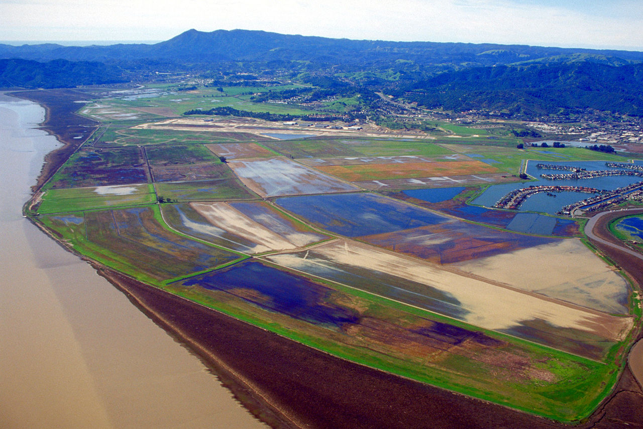
Managed realignment
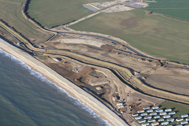
Managed realignment or managed retreat allows an area that was not previously exposed to flooding by the sea to become flooded by removing coastal ...
Multi-layer safety as a central concept for flood protection
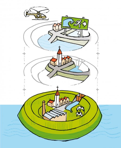
The central concept for the revised water safety policy is formed by 'multi-layer safety'. In this concept safety is assured through multiple layer...
Network of waterways
Ένα δίκτυο εσωτερικής ναυσιπλοΐας εστιάζει κυρίως στη διασύνδεση των υδάτινων σωμάτων που βρίσκονται σε κοντινές αποστάσεις. Συνδέοντάς τα, με υπόγ...
Polder
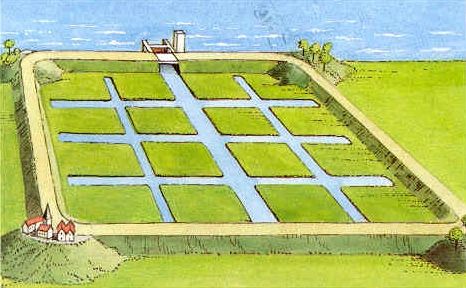
A polder is a low-lying tract of land enclosed by embankments (barriers) known as dikes that forms an artificial hydrological entity, meaning it ha...
Pond
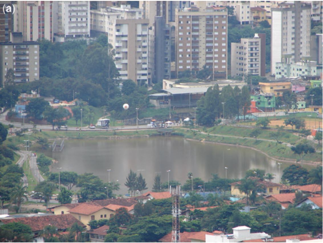
A pond is a body of standing water, either natural or artificial, that is usually smaller than a lake. They may arise naturally in floodplains as p...
Revetment
Revetments are sloping structures placed on banks or cliffs in such a way as to absorb the energy of incoming water. River or coastal revetments ar...
Rip rap
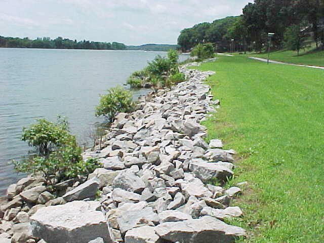
Rip rap is large boulders of rock that are placed along the edge of the coastline and is sometimes referred to as rock armouring. They work by diss...
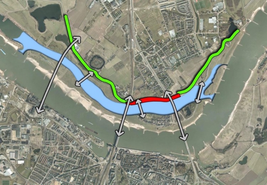
River Training
River training refers to the structural measures which are taken to improve a river and its banks. River training is an important component in the ...
Sediment replenishment
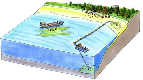
Sediment replenishment method is one of new measures of sediment management mostly used in river systems where dams/reservoirs have been created. I...
Toroba
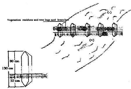
Toroba is a homemade diversion structure that is used to divert flood water for water supply augmentation. It is built of wooden poles, taken from ...
Wetland and wetland restoration
A wetland (Natural or Constructed/Artificial) is a land area that is saturated with water, either permanently or seasonally, such that it takes on ...

Flood management measures
| Name | Definition |
|---|---|
| Afforestation | Land use conversion is a general term for large scale geographic change. Afforestation is one such land conversion in which ... |
| Aquifer recharge | Aquifer recharge is achieved by adding surface water in basins, furrows, ditches, wells or other facilities where it infiltrates into ... |
| Bypass channel | Bypass channel, also known as a flood-relief channel, is an artificially made waterway constructed in order to protect urban and ... |
| Fascine | A fascine is a bundle of sticks or brushwood used in construction, generally to strengthen an earthen structure, fill ditches, ... |
| Floodplain excavation | Floodplain excavation is a measure by which gradual height increase caused by sedimentation on flood plains may be counteracted. The ... |
| Groyne | A groyne is normally a straight structure perpendicular to the shoreline. Groynes work by blocking (part of) the littoral drift, ... |
| Hydraulic filling | Hydraulic Fill is fill in which the materials are deposited by a flowing stream of water. This fill material will ... |
| Managed realignment | Managed realignment or managed retreat allows an area that was not previously exposed to flooding by the sea to become ... |
| Multi-layer safety as a central concept for flood protection | The central concept for the revised water safety policy is formed by 'multi-layer safety'. In this concept safety is assured ... |
| Network of waterways | Ένα δίκτυο εσωτερικής ναυσιπλοΐας εστιάζει κυρίως στη διασύνδεση των υδάτινων σωμάτων που βρίσκονται σε κοντινές αποστάσεις. Συνδέοντάς τα, με υπόγεια ... |
| Polder | A polder is a low-lying tract of land enclosed by embankments (barriers) known as dikes that forms an artificial hydrological ... |
| Pond | A pond is a body of standing water, either natural or artificial, that is usually smaller than a lake. They ... |
| Revetment | Revetments are sloping structures placed on banks or cliffs in such a way as to absorb the energy of incoming ... |
| Rip rap | Rip rap is large boulders of rock that are placed along the edge of the coastline and is sometimes referred ... |
| River Training | River training refers to the structural measures which are taken to improve a river and its banks. River training is ... |
| Sediment replenishment | Sediment replenishment method is one of new measures of sediment management mostly used in river systems where dams/reservoirs have been ... |
| Toroba | Toroba is a homemade diversion structure that is used to divert flood water for water supply augmentation. It is built ... |
| Wetland and wetland restoration | A wetland (Natural or Constructed/Artificial) is a land area that is saturated with water, either permanently or seasonally, such that ... |