
 Ελληνικά
Flood management measures
Afforestation
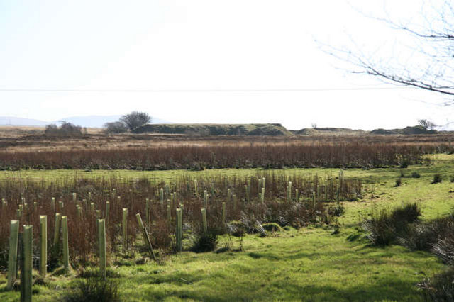
Land use conversion is a general term for large scale geographic change. Afforestation is one such land conversion in which trees are planted on pr...
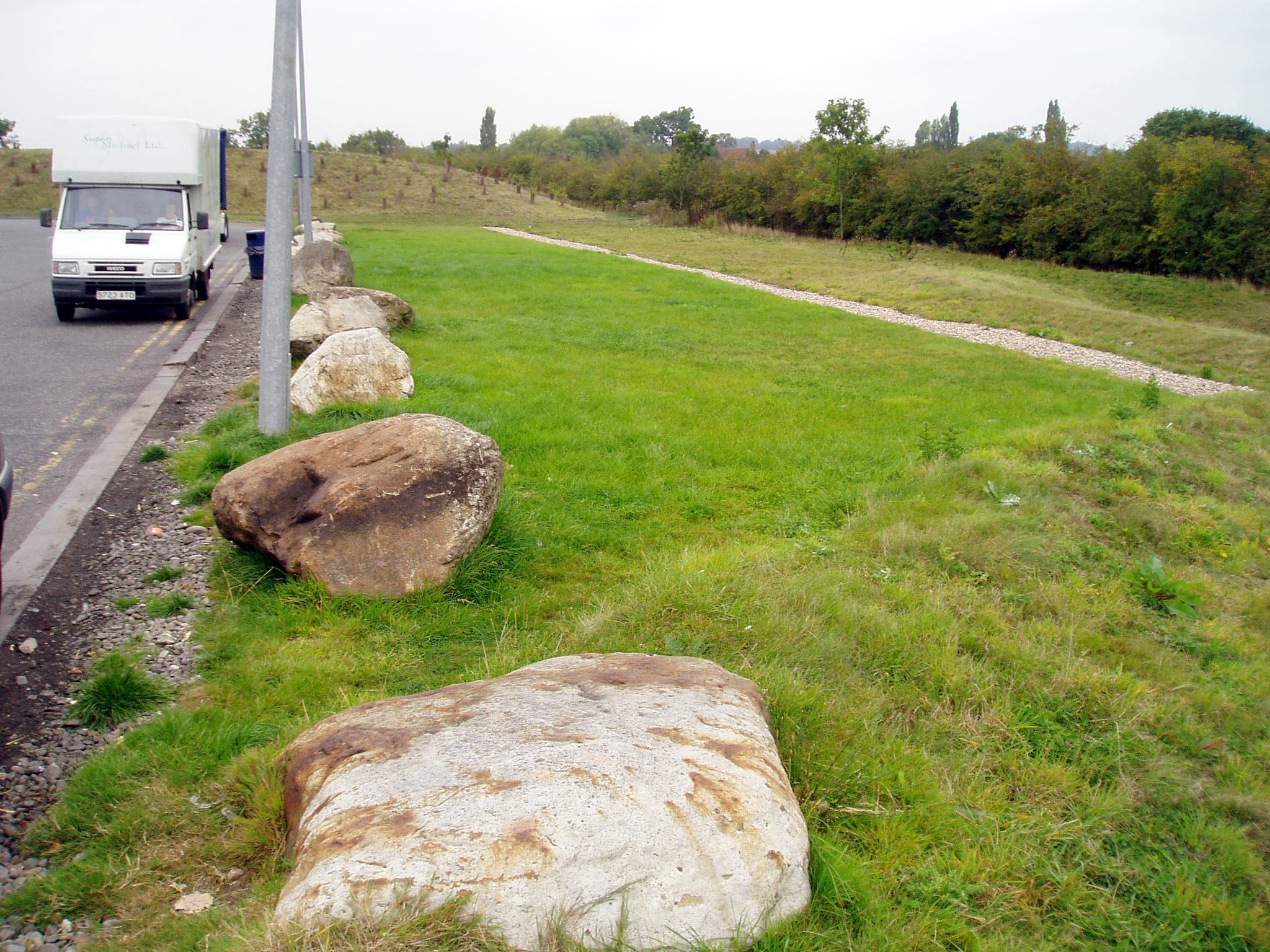
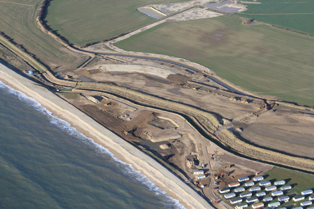
Artificial sand dunes and dune rehabilitation
Naturally occurring sand dunes are wind-formed sand deposits representing a store of sediment in the zone just landward of normal high tides. Artif...
Beach nourishment

Beach nourishment is an adaptation technology primarily used in response to shoreline erosion, although flood reduction benefits may also occur. It...
Bioretention area
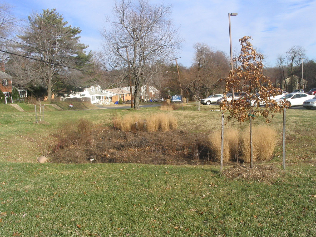
A bioretention area is a stormwater treatment system that is a depression integrated into the landscape. A bioretention area captures runoff from a...
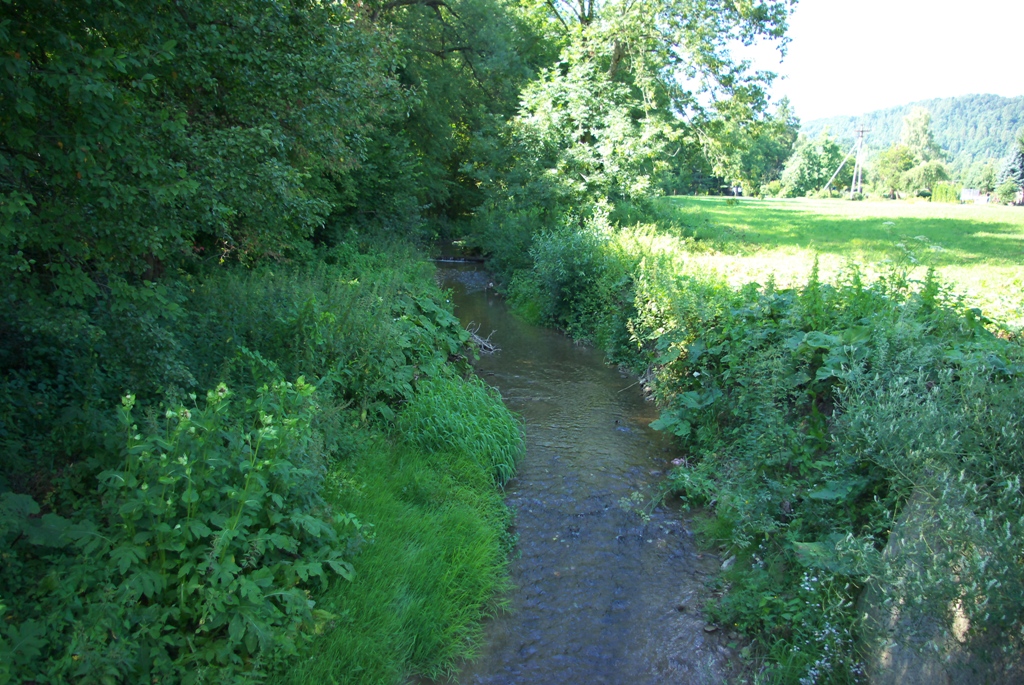
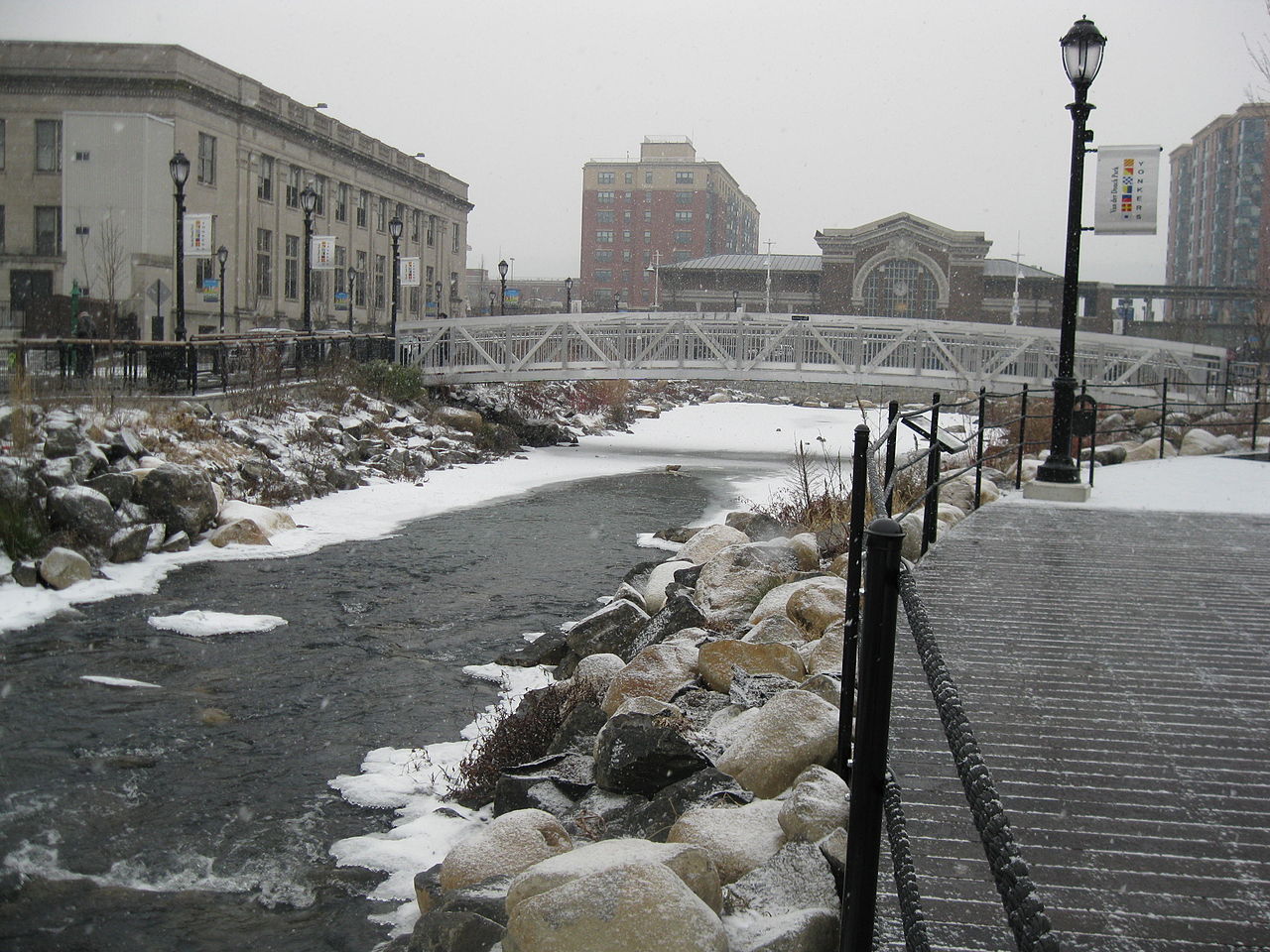
Bypass channel
Bypass channel, also known as a flood-relief channel, is an artificially made waterway constructed in order to protect urban and rural agricultural...
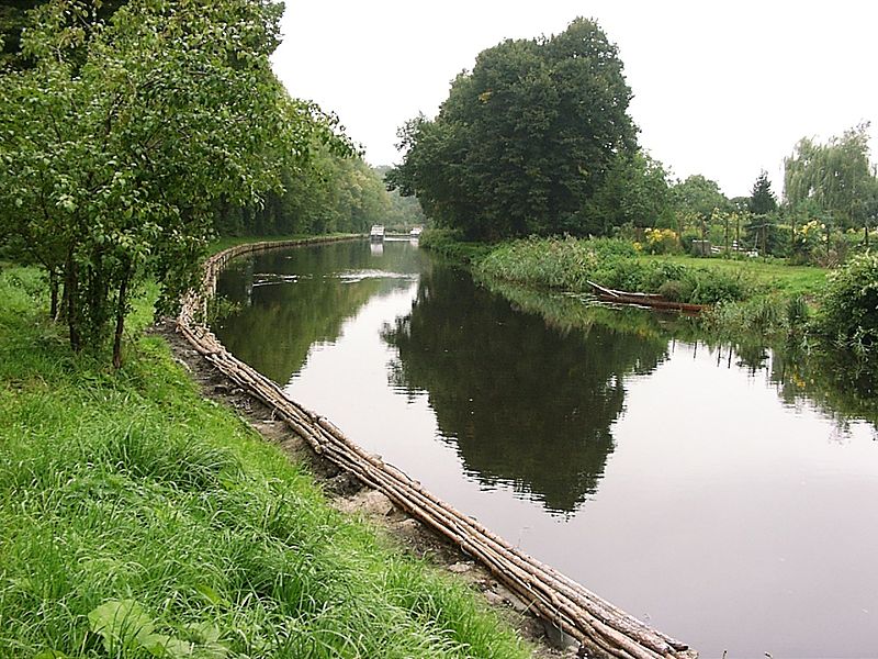
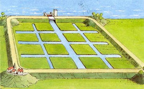
Canal and rill
Canals and rills are open surface water channels with hard edges. They are simply channels that water flows along whereby they can have a variety o...
Deculverting of watercourses
This activity involves techniques to resolve the issues created by culverted watercourses. This is predominantly through deculverting, or ‘daylight...
Fascine
A fascine is a bundle of sticks or brushwood used in construction, generally to strengthen an earthen structure, fill ditches, or make a path acros...
Filter strip
Filter strips are gently sloping, vegetated strips of land that provide opportunities for slow conveyance and infiltration (where appropriate). The...
Floating agricultural system
Floating agriculture is a way of utilising areas which are waterlogged for long periods of time in the production of food. The technology is mainly...
Flood detention reservoir
Flood detention reservoir, also known as an attenuation or balancing or flood control reservoir or detention basin, collects water at times of ve...
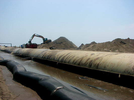
Hydraulic filling
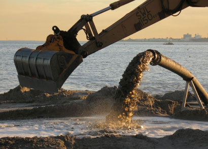
Hydraulic Fill is fill in which the materials are deposited by a flowing stream of water. This fill material will originate from a borrow area or d...
Increase of infiltration capacity
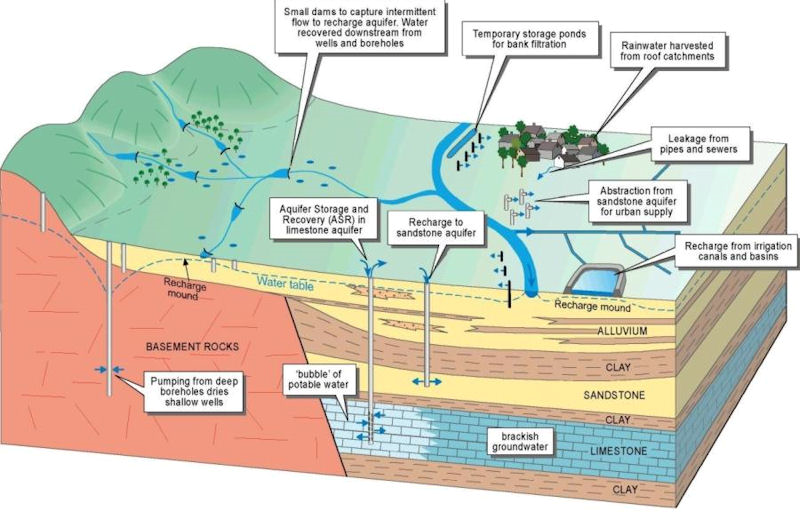
Improving the soil infiltration capacity means improving the permeability of the soil. If the infiltration capacity of the soil is increased, more ...
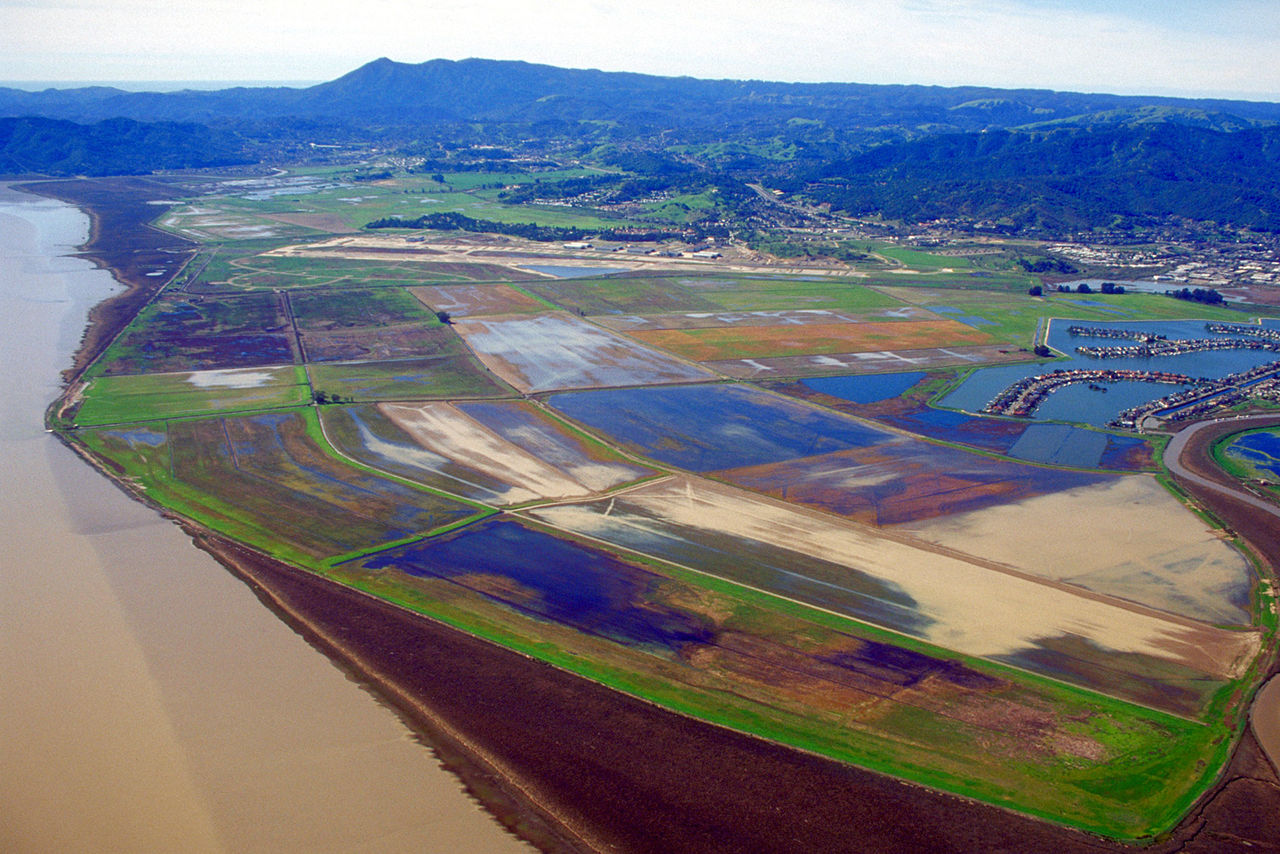
Land claim
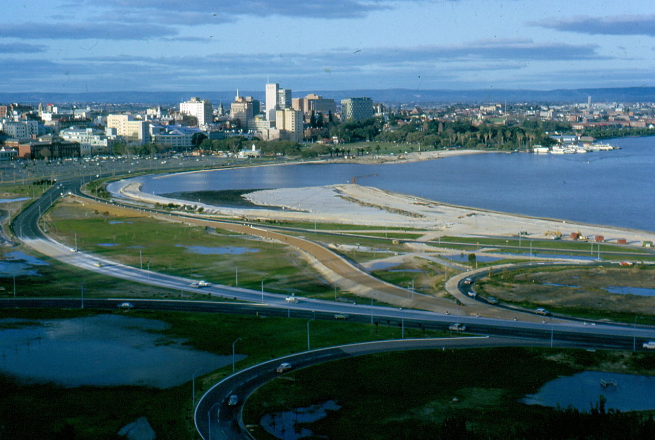
The main objective of land claim is neither erosion nor storm reduction. The aim of land claim is instead, to create new land from areas that were ...
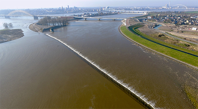
Managed realignment
Managed realignment or managed retreat allows an area that was not previously exposed to flooding by the sea to become flooded by removing coastal ...
Multi-layer safety as a central concept for flood protection
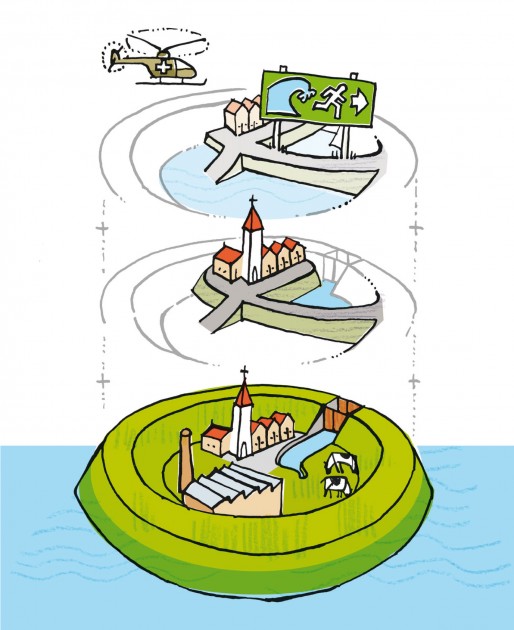
The central concept for the revised water safety policy is formed by 'multi-layer safety'. In this concept safety is assured through multiple layer...
Network of waterways
Ένα δίκτυο εσωτερικής ναυσιπλοΐας εστιάζει κυρίως στη διασύνδεση των υδάτινων σωμάτων που βρίσκονται σε κοντινές αποστάσεις. Συνδέοντάς τα, με υπόγ...
Polder
A polder is a low-lying tract of land enclosed by embankments (barriers) known as dikes that forms an artificial hydrological entity, meaning it ha...
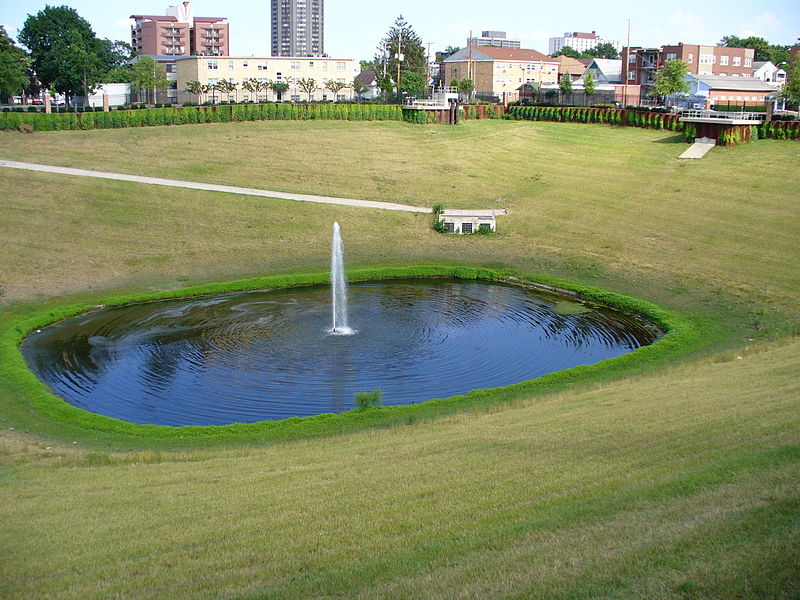
Pond
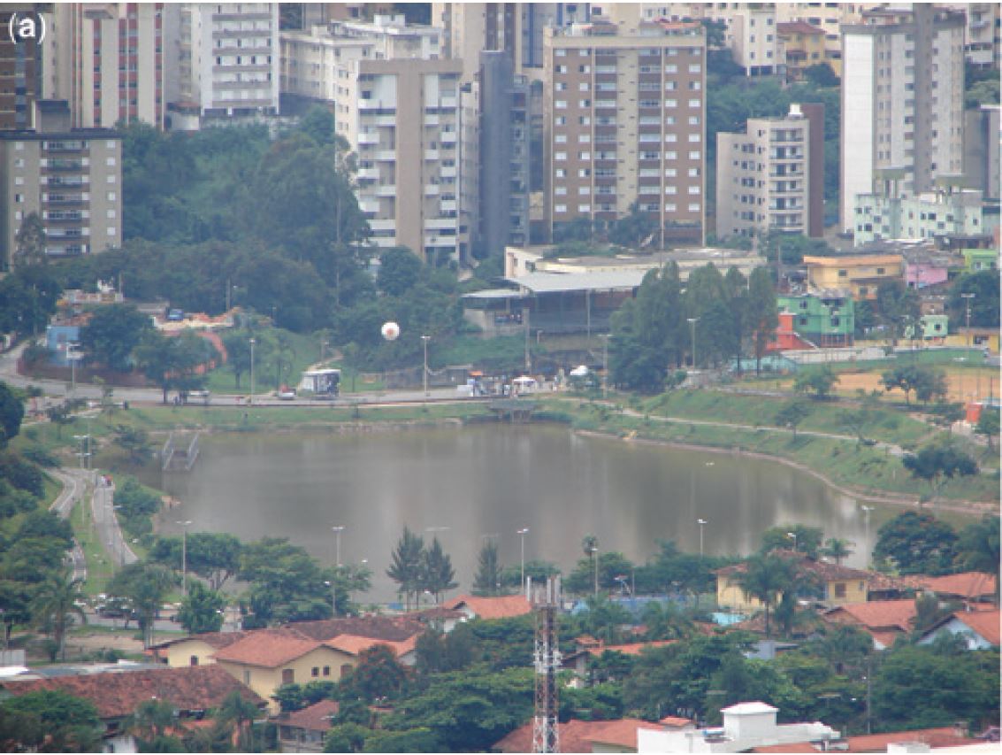
A pond is a body of standing water, either natural or artificial, that is usually smaller than a lake. They may arise naturally in floodplains as p...
Rainwater storage beneath sports fields
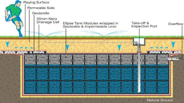
One option for creating additional water storage facilities is storing in underground crates. This is a hidden technology that fits the criteria of...
River Training
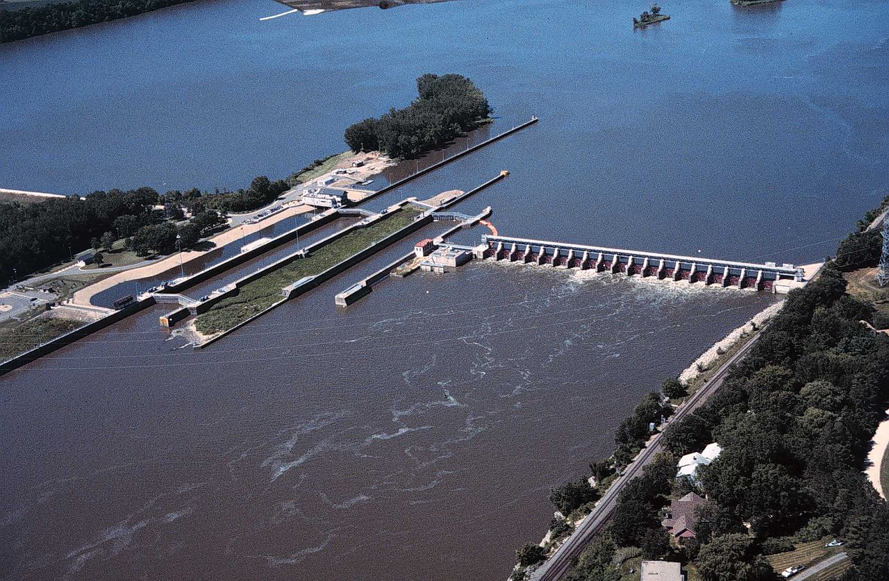
River training refers to the structural measures which are taken to improve a river and its banks. River training is an important component in the ...
Swale
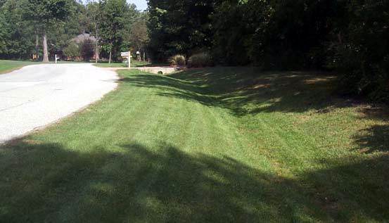
A swale is a low tract of land, especially one that is moist or marshy. The term can refer to a natural landscape feature or a human-created one. A...
Urban forest and park
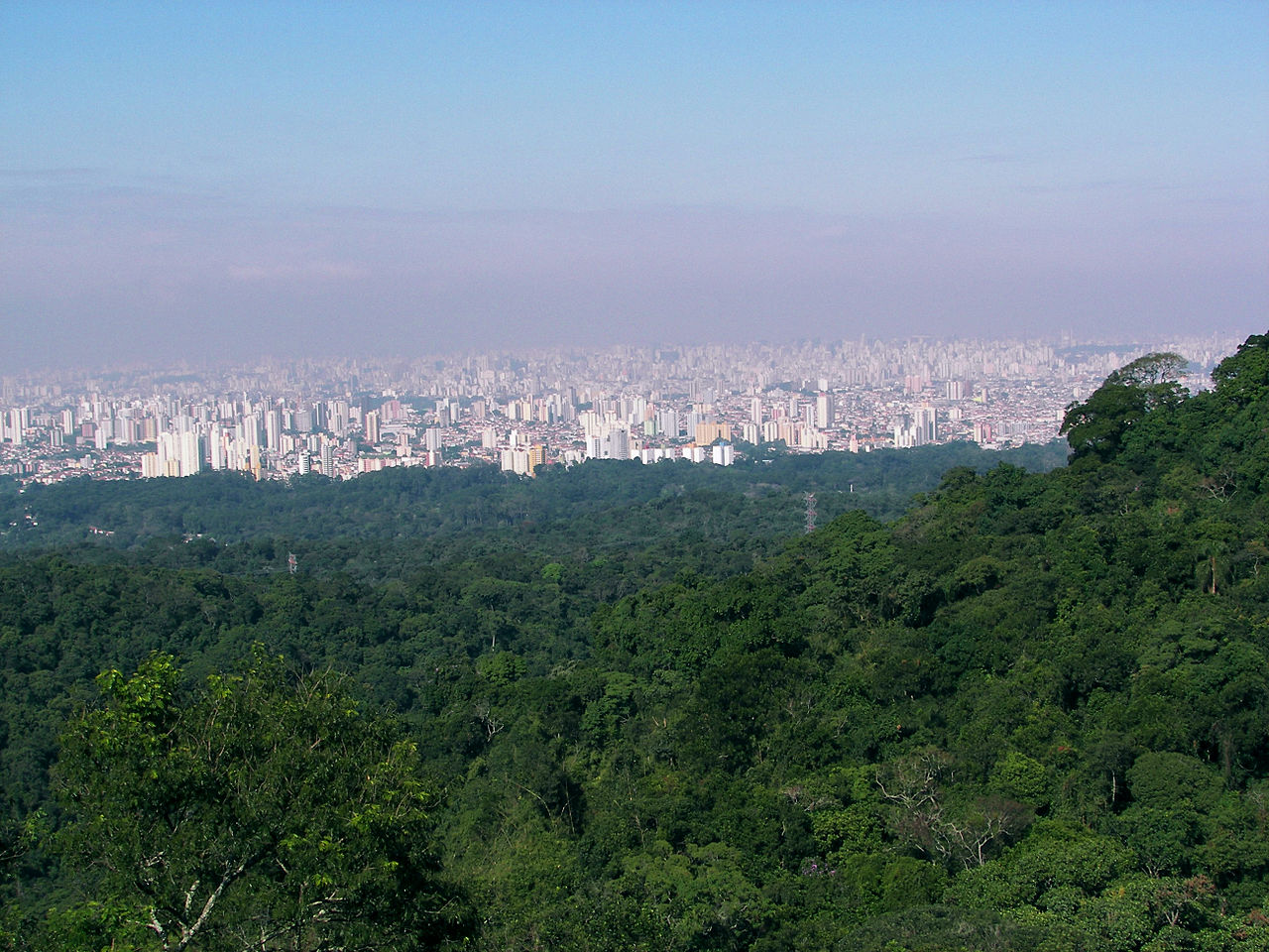
An urban forest is a forest or a collection of trees that grow within a city, town or a suburb. In a wider sense it may include any kind of woody p...
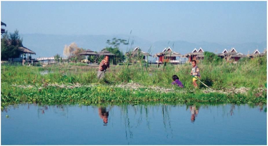
Wetland and wetland restoration
A wetland (Natural or Constructed/Artificial) is a land area that is saturated with water, either permanently or seasonally, such that it takes on ...

Flood management measures
| Name | Definition |
|---|---|
| Afforestation | Land use conversion is a general term for large scale geographic change. Afforestation is one such land conversion in which ... |
| Artificial sand dunes and dune rehabilitation | Naturally occurring sand dunes are wind-formed sand deposits representing a store of sediment in the zone just landward of normal ... |
| Beach nourishment | Beach nourishment is an adaptation technology primarily used in response to shoreline erosion, although flood reduction benefits may also occur. ... |
| Bioretention area | A bioretention area is a stormwater treatment system that is a depression integrated into the landscape. A bioretention area captures ... |
| Bypass channel | Bypass channel, also known as a flood-relief channel, is an artificially made waterway constructed in order to protect urban and ... |
| Canal and rill | Canals and rills are open surface water channels with hard edges. They are simply channels that water flows along whereby ... |
| Deculverting of watercourses | This activity involves techniques to resolve the issues created by culverted watercourses. This is predominantly through deculverting, or ‘daylighting’ which ... |
| Fascine | A fascine is a bundle of sticks or brushwood used in construction, generally to strengthen an earthen structure, fill ditches, ... |
| Filter strip | Filter strips are gently sloping, vegetated strips of land that provide opportunities for slow conveyance and infiltration (where appropriate). They ... |
| Floating agricultural system | Floating agriculture is a way of utilising areas which are waterlogged for long periods of time in the production of ... |
| Flood detention reservoir | Flood detention reservoir, also known as an attenuation or balancing or flood control reservoir or detention basin, collects water at ... |
| Hydraulic filling | Hydraulic Fill is fill in which the materials are deposited by a flowing stream of water. This fill material will ... |
| Increase of infiltration capacity | Improving the soil infiltration capacity means improving the permeability of the soil. If the infiltration capacity of the soil is ... |
| Land claim | The main objective of land claim is neither erosion nor storm reduction. The aim of land claim is instead, to ... |
| Managed realignment | Managed realignment or managed retreat allows an area that was not previously exposed to flooding by the sea to become ... |
| Multi-layer safety as a central concept for flood protection | The central concept for the revised water safety policy is formed by 'multi-layer safety'. In this concept safety is assured ... |
| Network of waterways | Ένα δίκτυο εσωτερικής ναυσιπλοΐας εστιάζει κυρίως στη διασύνδεση των υδάτινων σωμάτων που βρίσκονται σε κοντινές αποστάσεις. Συνδέοντάς τα, με υπόγεια ... |
| Polder | A polder is a low-lying tract of land enclosed by embankments (barriers) known as dikes that forms an artificial hydrological ... |
| Pond | A pond is a body of standing water, either natural or artificial, that is usually smaller than a lake. They ... |
| Rainwater storage beneath sports fields | One option for creating additional water storage facilities is storing in underground crates. This is a hidden technology that fits ... |
| River Training | River training refers to the structural measures which are taken to improve a river and its banks. River training is ... |
| Swale | A swale is a low tract of land, especially one that is moist or marshy. The term can refer to ... |
| Urban forest and park | An urban forest is a forest or a collection of trees that grow within a city, town or a suburb. ... |
| Wetland and wetland restoration | A wetland (Natural or Constructed/Artificial) is a land area that is saturated with water, either permanently or seasonally, such that ... |